WORLDBASEMAPSContact

All-Weather Basemap

Radar basemap, updated with every pass

An ever-fresh worldwide SAR basemap from Sentinel-1 (and soon NISAR) — updated live with every new pass, typically every 3–24 days depending on ESA’s acquisition plan, day, night and through cloud.

Many locations and seasons are extremely cloudy, where all satellite imagery other than SAR sources is not available. SAR data uses active radar which penetrates clouds and rain, but its data is different from optical and often requires expertise to interpret. Worldwide SAR has been available since 2015 through ESA Sentinel-1 and a new NASA/ISRO NISAR satellite coming online fully around 2027, partially available 2026. The basemap imagery is grayscale visualization (see Enhanced SAR data for source data access).

Sources:

The all-weather basemap continuously processes new SAR captures worldwide, making it easily available with the following capabilities:

On average about two thirds of the Earth is under cloud at any time. [1] Sentinel-1 radar images the ground day and night regardless of cloud [3], and NISAR adds L-band and S-band radar. [4]
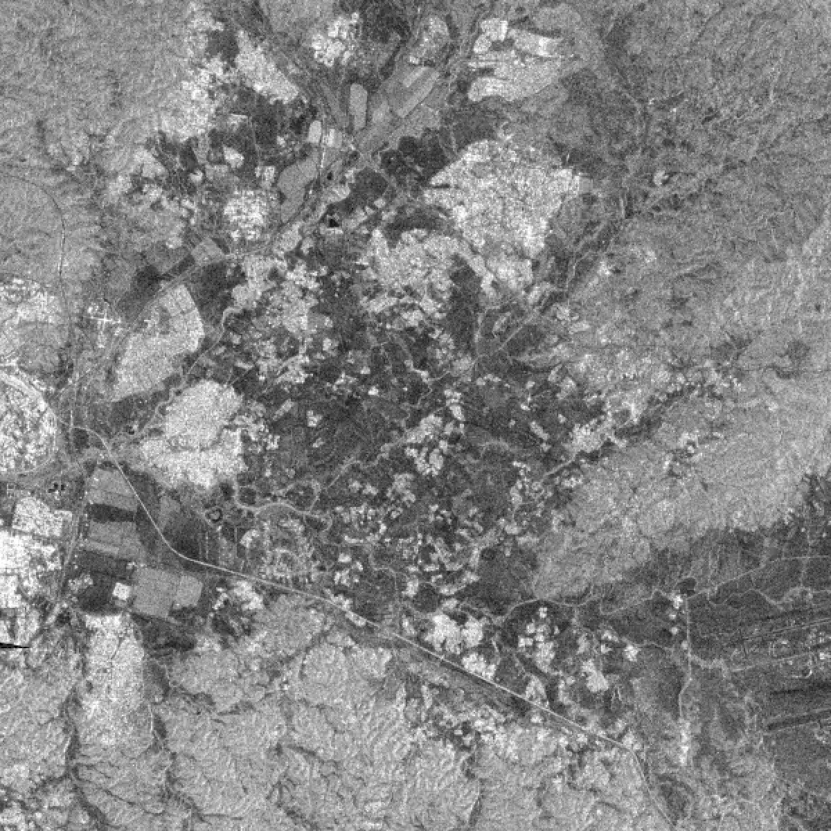
Live all-weather SAR basemap
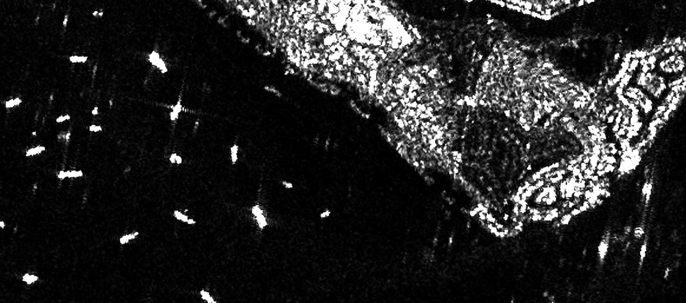
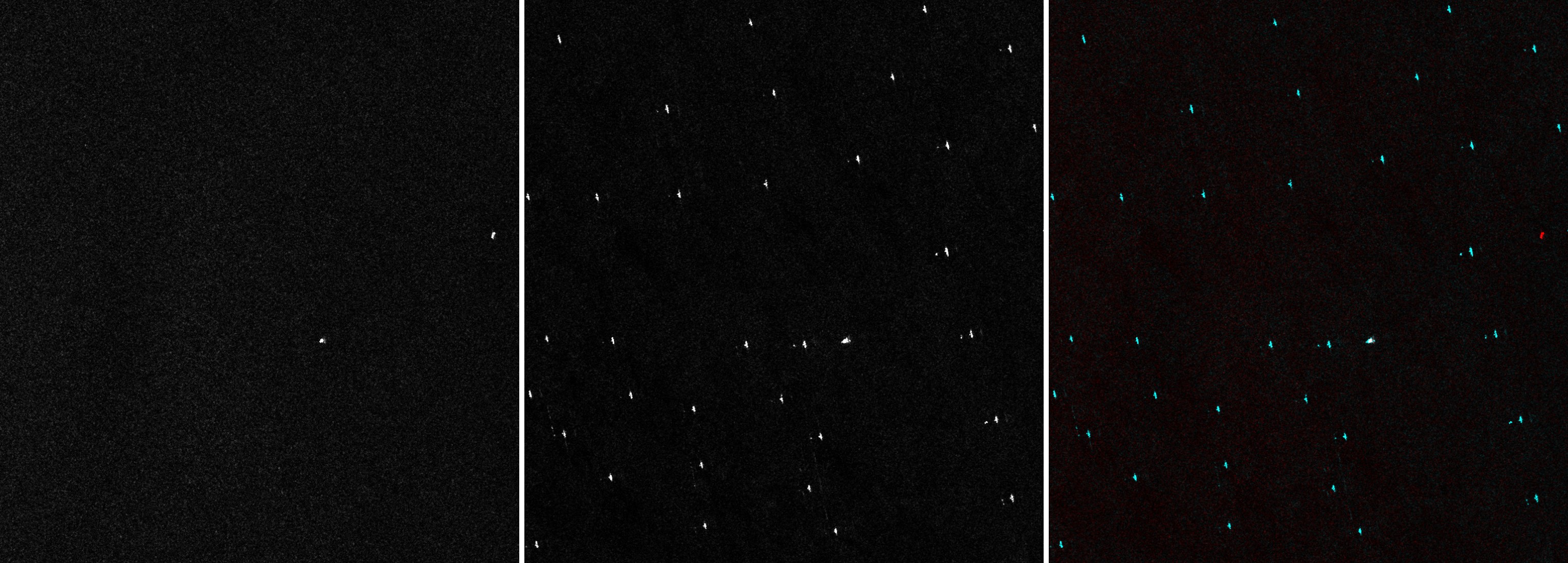
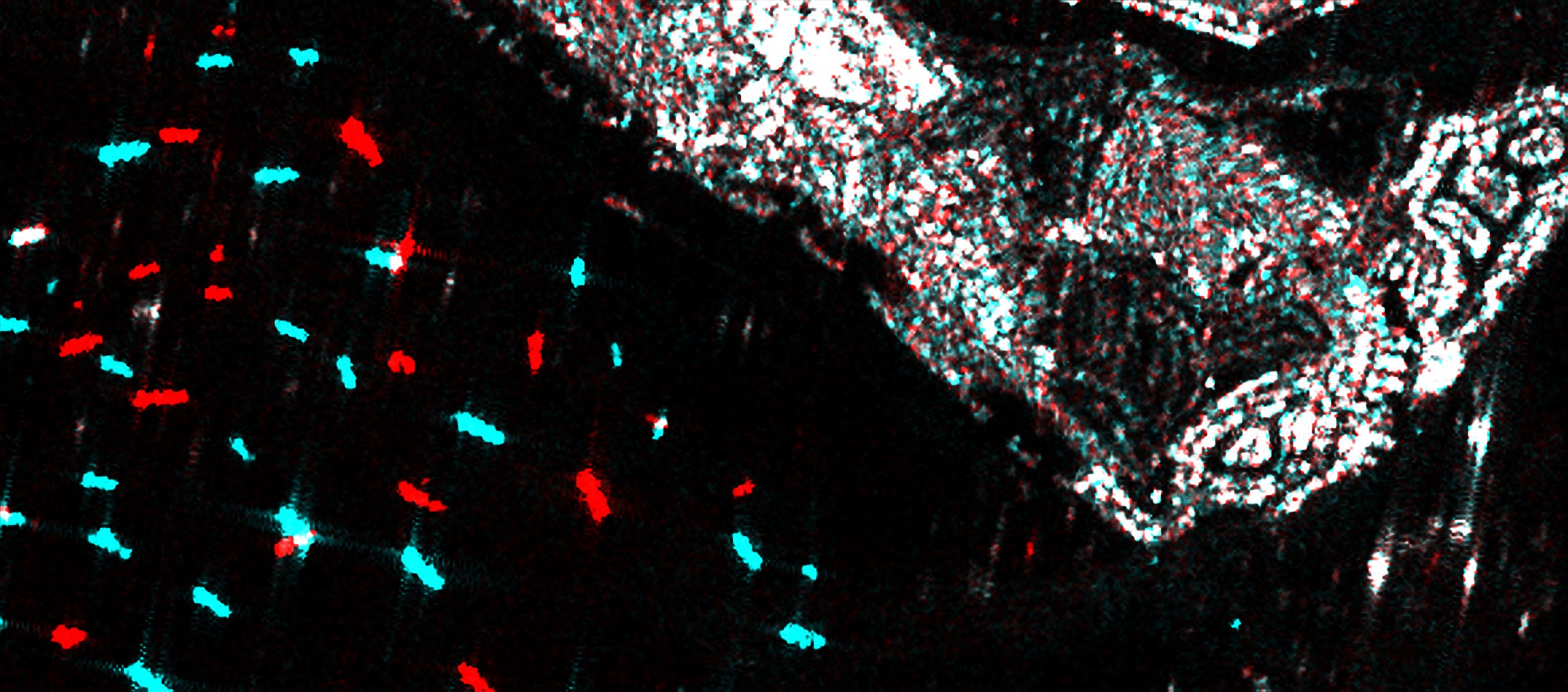
Singapore anchorage — Sentinel-1 VV on 15 Nov and 3 Nov 2026; change view: red = present only on 15 Nov, cyan = present only on 3 Nov

Change at a glance

The latest and previous captures are pixel-aligned, so a change view shows what appeared and what left between two passes, for example ships at anchor, flooding or construction.

Ask for an area →

Ships at anchor off the port, Singapore — Sentinel-1 VV at 2.5m, 15 Nov 2026
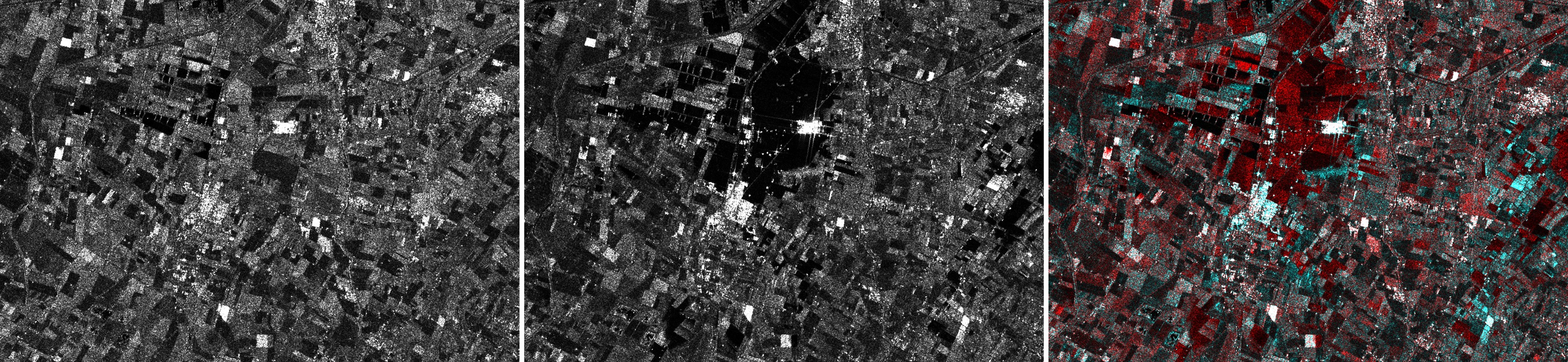
Flood — Conselice, Emilia-Romagna, Italy: VV 2.5m, 10 May and 22 May 2023, same orbit, change (red = darker, flooded)
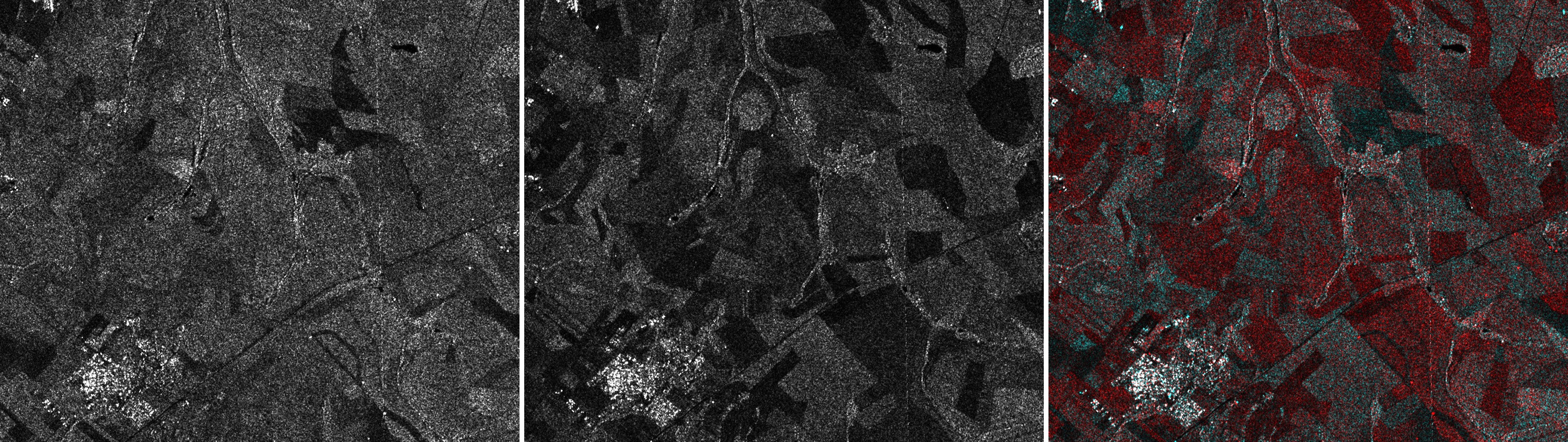
Sugarcane harvest — near Ribeirão Preto, São Paulo, Brazil: VV 2.5m, 12 May and 4 Aug 2023, same orbit, change (red = backscatter drop, harvested)
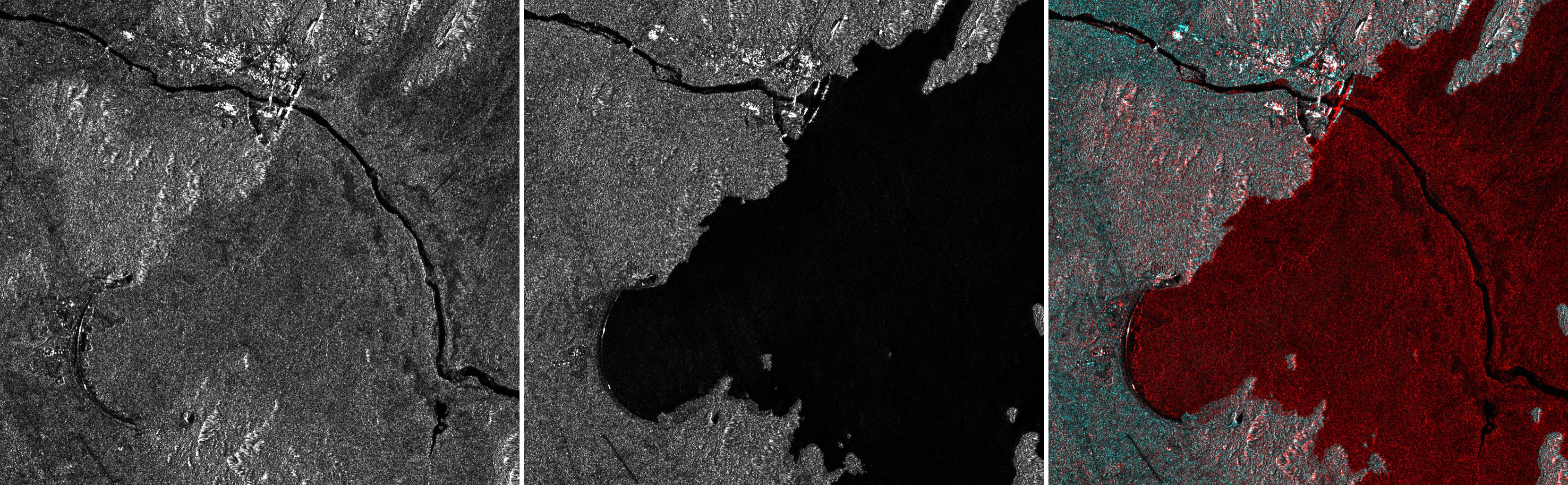
Reservoir filling — Grand Ethiopian Renaissance Dam, Ethiopia: VV 2.5m, 22 May 2020 and 28 Sep 2023, same orbit, change (red = now water)
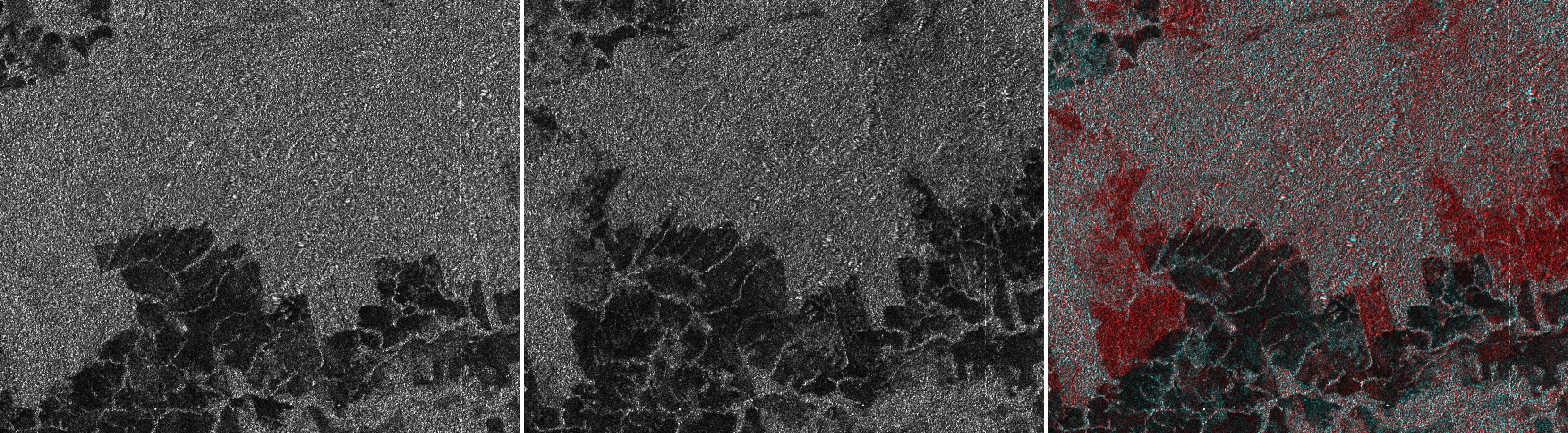
Deforestation — Novo Progresso, Pará, Brazil: VV 2.5m, 26 Jul 2019 and 29 Jul 2023, same orbit, change (red = cleared forest)
Offshore wind farm construction — Hollandse Kust Zuid, Netherlands: VV 2.5m, 31 May 2021 and 25 Aug 2023, same orbit, change (cyan = new turbines)
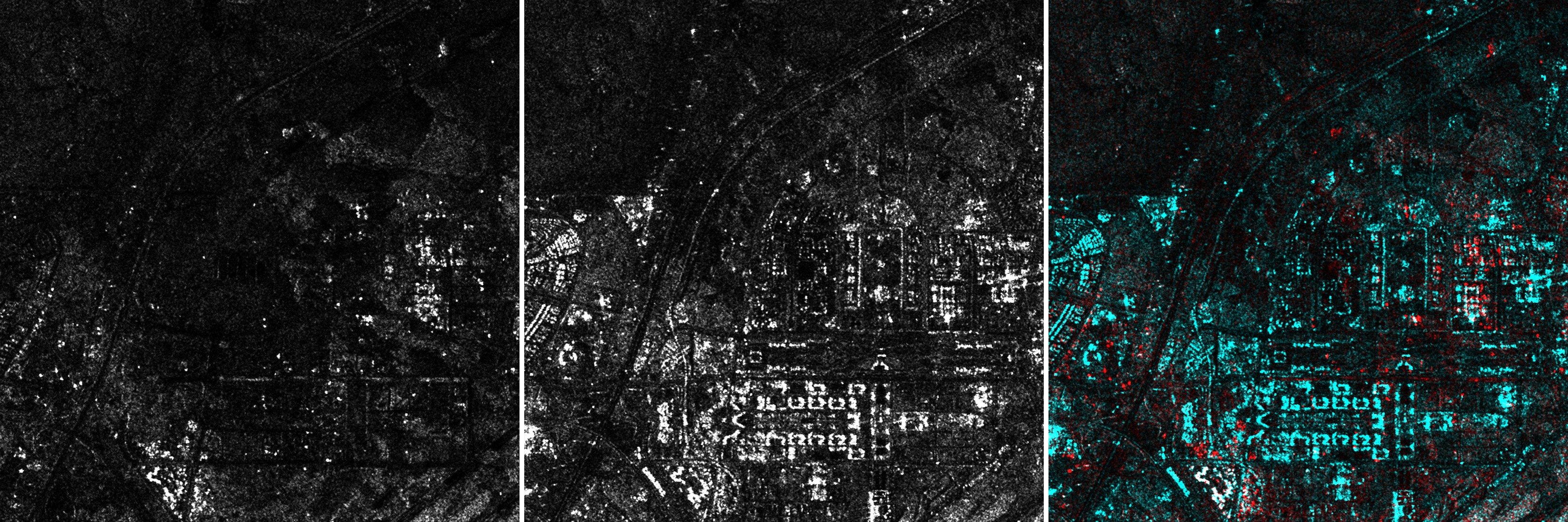
New city construction — New Administrative Capital, Egypt: VV 2.5m, 1 Jun 2017 and 24 May 2022, same orbit, change (cyan = new buildings)
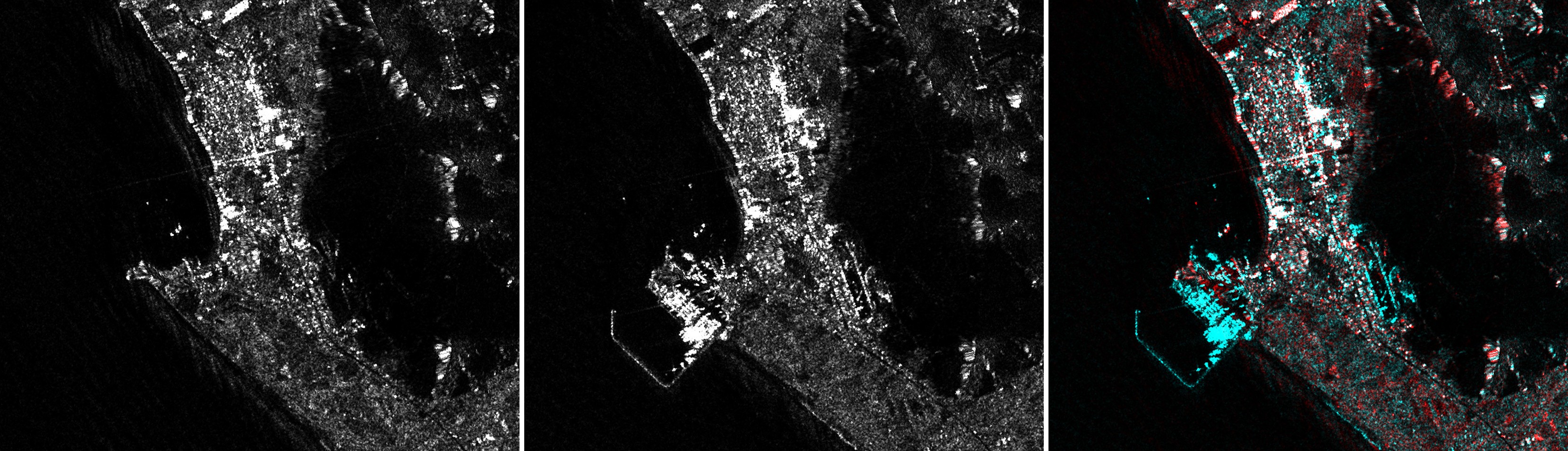
Port construction through coastal fog — Chancay, Peru: VV 2.5m, 1 Jun 2021 and 18 Nov 2024, same orbit, change (cyan = new port and breakwater)